| The
Denmark Expedition 1906-08
|
|
|
|
|
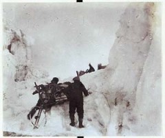
Sledge
party on the Denmark Expedition 1906-08. A primitve devive for measuring
distances – created from a bicycle wheel and a counting device – is
attached to the back of the sledge.
|
|
|
|
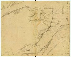
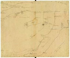
Høegh
Hagens sketch maps of Kronprins Christians Land, found by J. P. Koch on
the body of Jørgen Brønlund in 1908.
|
|
|
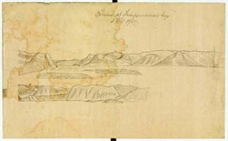
Høegh
Hagens horizon of the interior of Independence Bay, found by J. P. Koch
on the body of Jørgen Brønlund in 1908.
|
|
|
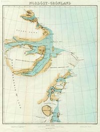
J. P. Koch's map showing Kronprins Christian's Land Meddelelser om Grønland, Bd. XLVI, 1911. |
| Back Next |