| The
1st and 2nd Thule Expeditions
|
|
In 1912 Einar Mikkelsen returned from the Alabama Expedition 1909-1912 bringing with him a cairn report by Mylius Erichsen containing the sentence ”The Peary Channel does not exist”. In the same year Knud Rasmussen and Peter Freuchen on the 1st Thule Expedition 1912-13 reached the interior of Independence Bay, and discovered a land bridge between Navy Cliff and Heilprin Land. In 1913 the cartographic results of the Danish expeditions were used in an attack launched on Peary in the American Congress accusing him of cartographic swindle. As a result all official American maps showing the Peary Channel were withdrawn. |
|
|
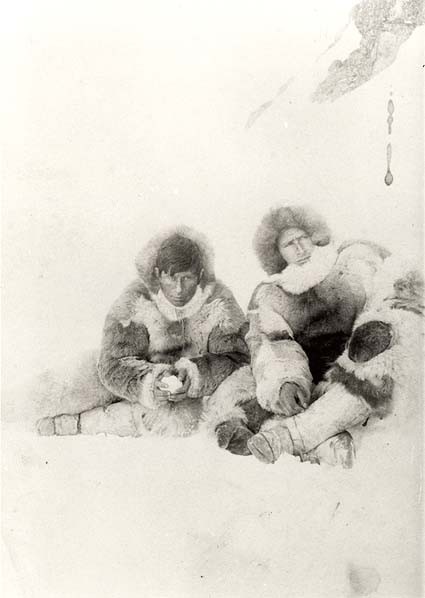
Peter Freuchen (left) and Knud Rasmussen on the 1st Thule Expedition.
|
|
|
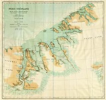
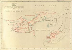
Map
of the route of the 1st Thule Expedition. Belongs to the Library of the Geographical Institute of the University of Copenhagen.
|
|
|
Peter
Freuchens map of the land connecting Navy Cliff and Heilprin Land, 1912. Belongs
to the Library of the Geographical Institute of the University of
Copenhagen.
|
|
In 1916 Lauge Koch joined Knud Rasmussens 2nd Thule Expedition 1916-18. As the expeditions cartographer he was charged with the mapping of the northern parts of the socalled Peary Channel. In 1917 Koch and Rasmussen found the channels northerne outlet closed by glaciers. In the same year USA reliqiushed all claims to northern Greenland, acknowledging Denmarks sovereign rights to all of Greenland. When Peary died in 1920 the map showed inland ice where he had originally drawn his channel.
|
|
|
|
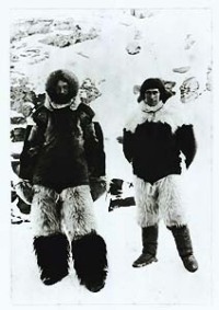
Knud
Rasmussen (left) and Lauge Koch on the 2nd Thule Expedition. The
picture belongs to Carl Koch.
|
|
|
|
The northernmost area traversed by the 2. Thule Expedition. Meddelelser
om Grønland, Vol. 64, No. 2, 1922.
|
|
|
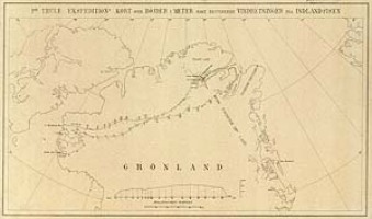
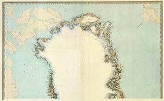
Map
of North Greenland issued by the Commision for Scientific Research i
Greenland, 1918. |
| Back Next |